It connects London’s National Cycle Network, Cycleways and the extended cycle network to green spaces and waterways
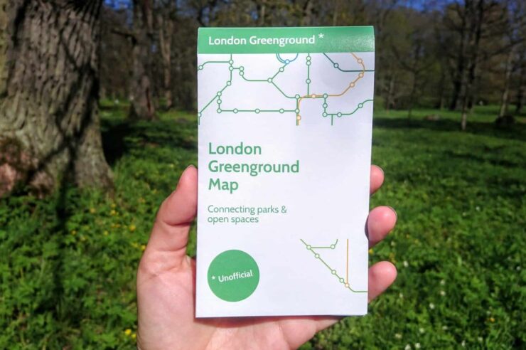
Back in 2021, graphic designer Helen Ilus released the Greenground Map. Inspired by Harry Beck’s iconic tube map, it joined the dots between London’s parks and nature spots, helping people to travel across London amid greenery.
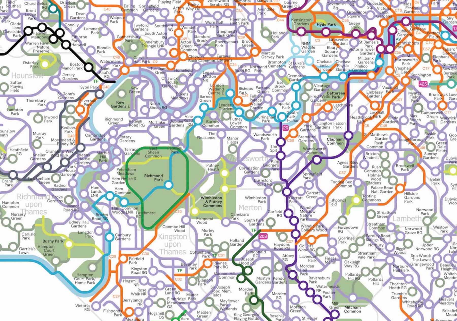
Instead of tube stations, it linked the city’s urban oases: from forests and cemeteries to parks and waterways. And now, Ilus has released a new version – designed specifically for cyclists.
The London Greenground Map – cycling edition is the first schematic city-wide map connecting the National Cycle Network, Cycleways and the extended cycle network to green spaces and waterways. “Since I released the original map five years ago, it has grown significantly, now featuring over a thousand green spaces,” Ilus told Positive News.
“The idea to make a cycling edition came from the people, who reached out and asked if I could include the cycle routes. Since the original walking map was already quite busy, I thought it would just be too cluttered. Then I realised: ‘Why not? I’ll just create a separate map!’
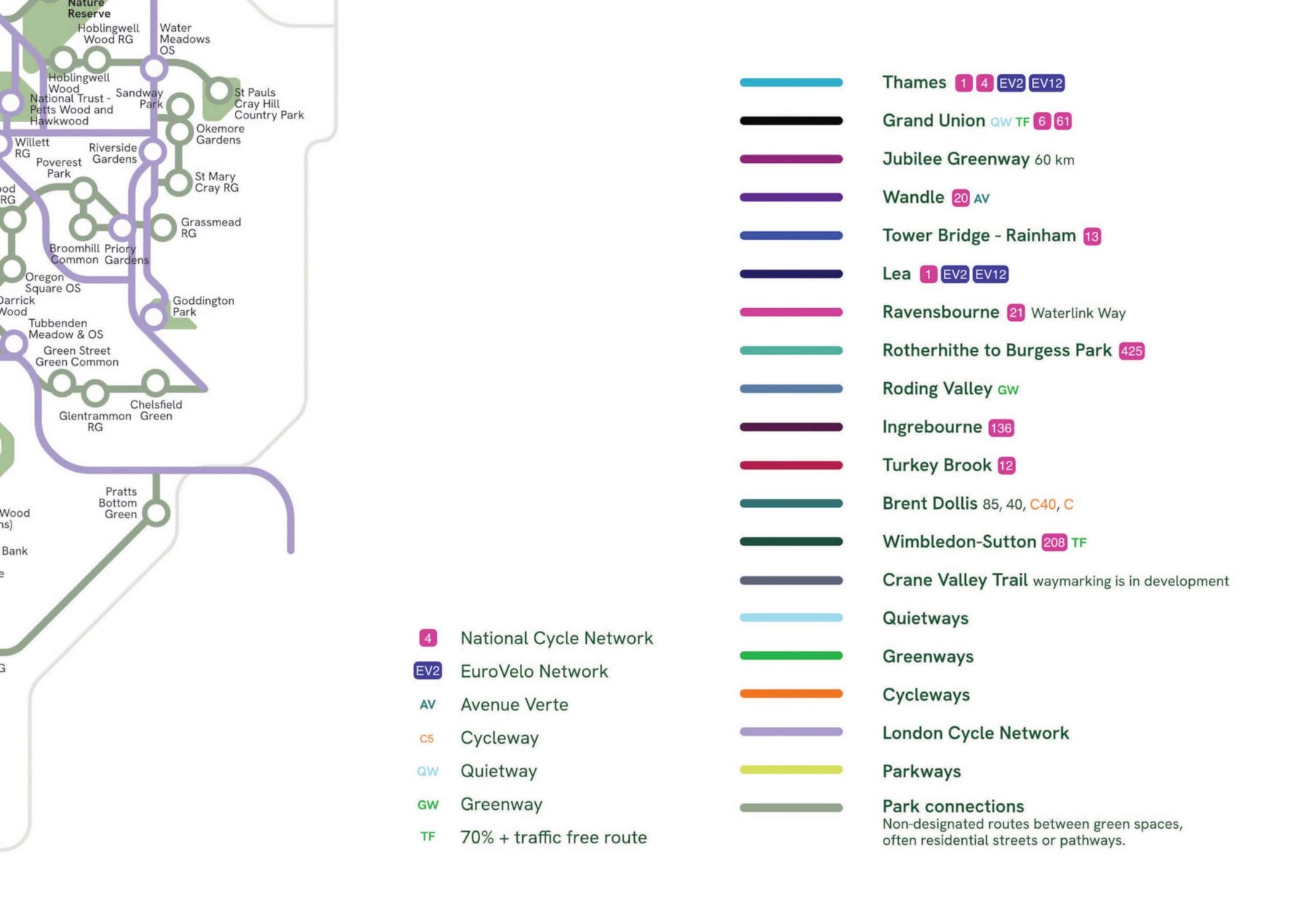
“I hope this map encourages cyclists to green their commutes or explore new routes for leisure cycling. Cycling is growing increasingly popular everywhere, but I think many of the cycle paths are not particularly green or enjoyable to cycle. Fortunately, London does have a network of routes that follow waterways, designated greenways or pass a number of parks. Lea Valley, River Ravensbourne and the Grand Union Canal are all examples of the ‘lines’ featured on this map.”
The map is free to download and, at current, the project is supported by voluntary donations. Ilus is also selling posters to help fund it.
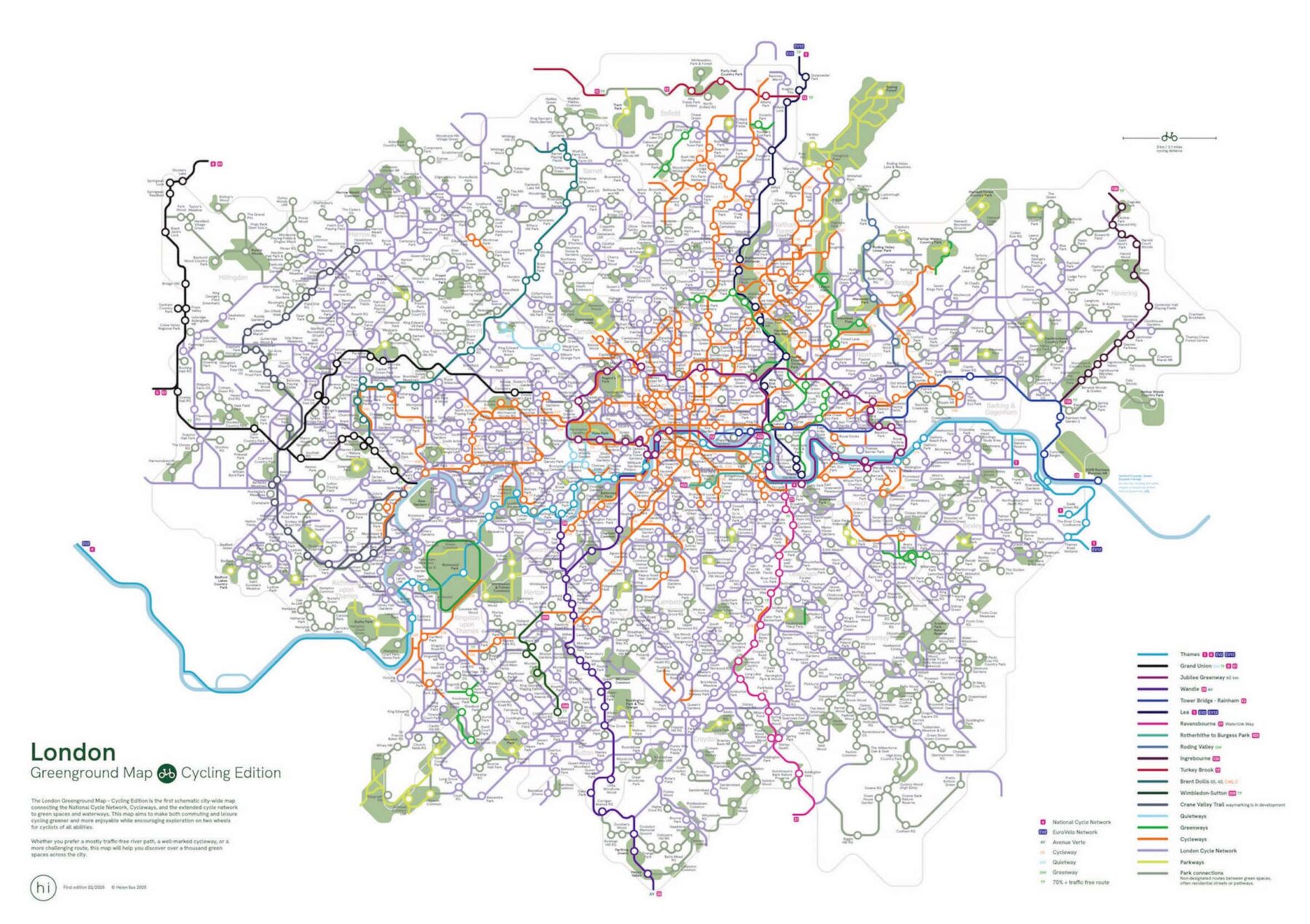
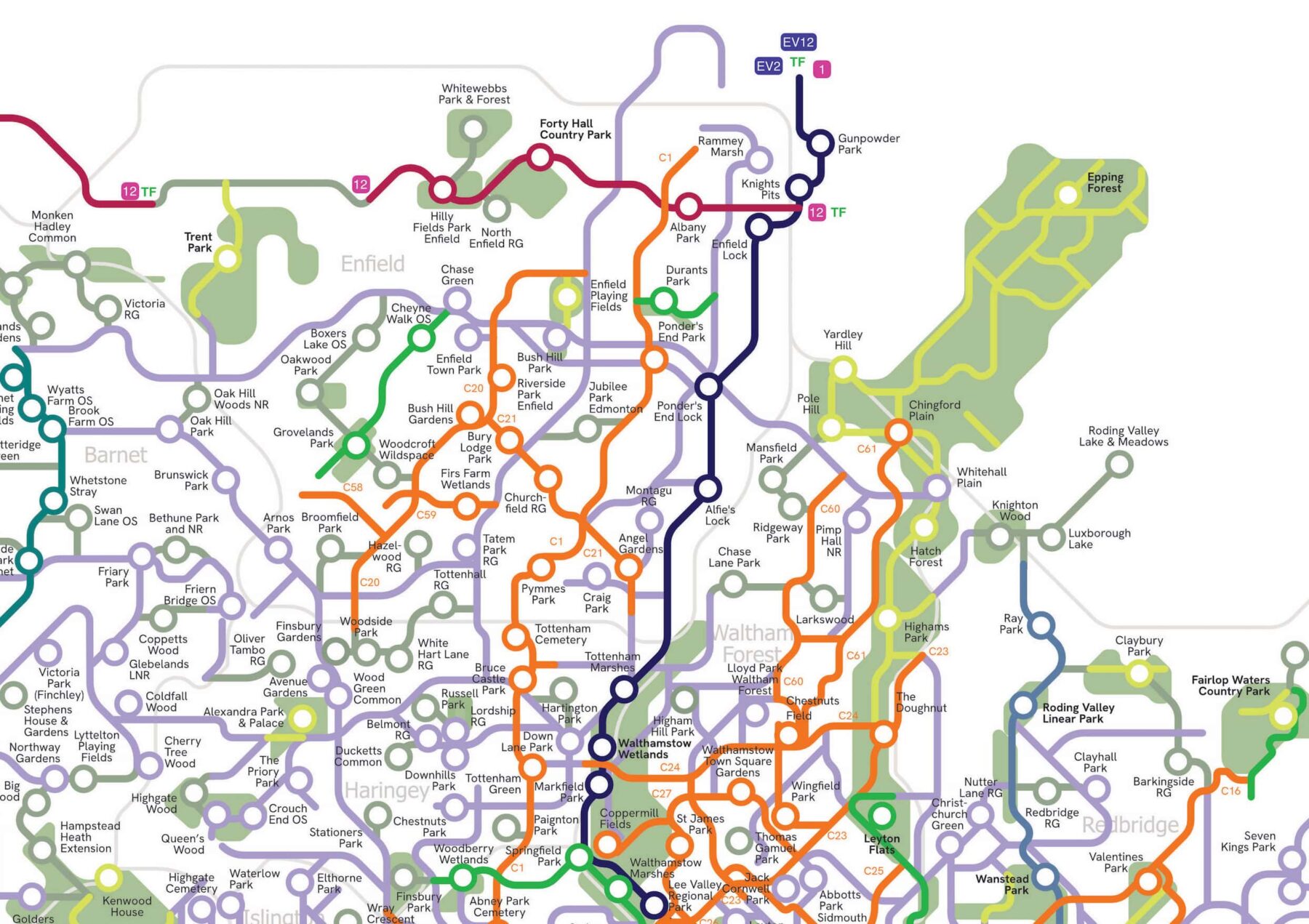
She explained the aim is to make both commuting and leisure cycling greener and more enjoyable, while encouraging exploration on two wheels for cyclists of all abilities. “Whether you prefer a mostly traffic-free river path, a well-marked cycleway or a more challenging route, this map will help you discover over a thousand green spaces across the city,” she said.
Ilus is currently based in Tallinn, the Estonian capital, so most of her maps – including this latest one – are based on online research. But she’s no stranger to the joy of life on two wheels.
“I cycle regularly here in the warmer months and last year I took a 300km solo bike tour around a local island. It was fantastic! I usually prefer cycling along green routes, through the parks and along rivers. So, when I next visit London, I’ll definitely be pedalling along one of the waterways!”
Images: Helen Ilus 2025
Be part of the solution
Positive News is helping more people than ever to get a balanced and uplifting view of the world. While doom and gloom dominates other news outlets, our solutions journalism exists to support your wellbeing and empower you to make a difference towards a better future.
But our reporting has a cost and, as an independent, not-for-profit media organisation, we rely on the financial backing of our readers. If you value what we do and can afford to, please get behind our team with a regular or one-off contribution.
Give once from just £1, or join 1,500+ others who contribute an average of £3 or more per month. You’ll be directly funding the production and sharing of our stories – helping our solutions journalism to benefit many more people.
Join our community today, and together, we’ll change the news for good.