A mobile mapping app that draws on crowdsourced data to help humanitarian responders find people in remote areas is being rolled out by Médecins Sans Frontières
A mobile mapping app that uses crowdsourced data to help responders find people in remote areas quickly, is being used by international medical humanitarian organisation Médecins Sans Frontières (MSF).
MSF estimates that the homes of hundreds of millions of people from the world’s most vulnerable communities are not mapped. It’s impossible for aid workers to know exactly where and how many people are living in these parts of the world. This makes it difficult to plan mass vaccination campaigns, understand how diseases are spreading as well as deliver other life-saving activities.
MSF personnel told the MSF’s Scientific Days meeting in London last week that the MapSwipe app has helped them locate people even during urgent missions – but that it needs work to be more reliable.
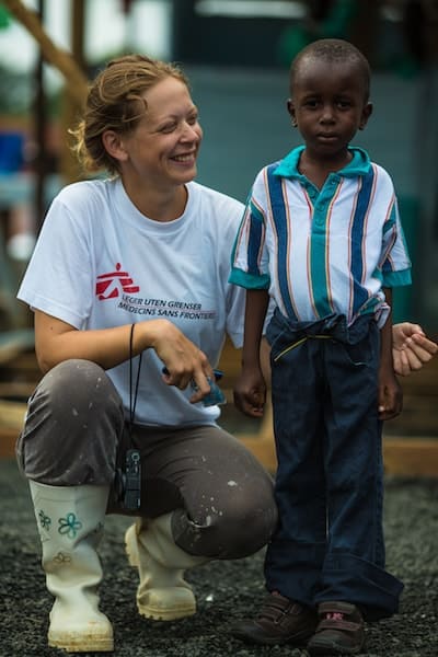
Ane Bjøru Fjeldsæter poses with six-year-old Patrick Poopei outside an Ebola treatment unit run by MSF, Liberia. Image: Morgana Wingard, 2014
Finding people fast in an emergency, whether an earthquake or disease outbreak, can make the difference between life and death. Better knowledge of West Africa could have helped tackle the 2014 Ebola epidemic faster, MSF has said.
Launched last year, MapSwipe asks citizens to put together detailed maps of areas where existing geographical information is basic. It draws on the open-source platform OpenStreetMap, and is part of the Missing Maps project designed by MSF and partners to ‘put vulnerable people on the map’.
The app works by supplying satellite imagery to volunteers who signal, through their phones, whether they recognise features, such as buildings, which are proxies for population. The app team aggregates this input to produce maps that reflect features on the ground more accurately.
It draws on an open-source platform and is part of the Missing Maps project designed to ‘put vulnerable people on the map’
Results from South Sudan and Madagascar show that about 90 per cent of the crowdsourced data agrees with each other — an indication that citizen feedback is reliable, says Benjamin Herfort, from Heidelberg University in Germany, a member of the team.
But in some cases, users disagree with each other, which is limiting the app’s ability to guide field staff.
“We will address this by giving better instructions and providing more image-based examples,” says Herfort.
Reliability is always a challenge and so good tutorials can help, says Patrick Meier, international consultant on humanitarian technologies. Meier has developed a similar tool, MicroMappers.
When MSF staff went to the field, the map was there
“What we did with MicroMappers is that any disagreements would be flagged for review,” Meier explains. “One can take a statistical approach and calculate areas of highest consensus.”
Herfort says MSF has already deployed MapSwipe in a few field sites, including urgent missions such as the city of Aweil in South Sudan. The app could effectively ‘shrink’ the area that needed detailed mapping from the initial site of 5800sq km to the 690sq km that proved to be inhabited.
Scoping the site was done even before responders reached the ground, Herfort says. “When MSF staff went to the field, the map was there.”
The initiative is valuable and should be supported according to Liz Hughes, chief executive of MapAction, a charity that provides mapping services in emergencies and publishes a field guide to humanitarian mapping.
This article originally appeared on SciDev.Net, here
Support journalism that shares your values
Featured image: Patrick on his new bike donated to him by MSF, Liberia. Credit: Morgana Wingard, 2014
